

Mounds And Vampires And Corn, Oh, My!
With COVID-19 restrictions loosening up a bit and with my children suffering from hardcore cabin fever, I decided to take my family on a road trip to a corner of my home state that I haven’t had an opportunity to explore. Although I spent quite a bit of time in the Monroe, LA area, and have visited Vicksburg, MS on a few occasions, I never took the time to check out the area between Monroe and the Mississippi River in northern Louisiana. That changed this weekend.
Myself and the kids set out on a 4.5 hour road trip to Transylvania, LA. We traveled up Highway 165 (a highway that I’ve driven on many, many times) and then hit Interstate 49 near the small town of Woodworth. We drove north of Alexandria and turned onto Highway 28. This highway took us by the Frogmore Plantation and the legendary city of Ferriday. Ferriday is perhaps best known for giving the world Jerry Lee Lewis, Jimmy Swaggart, and Mickey Gilley, three men that blazed trails in rock n’ roll, televangelism, and countrypolitan music, respectively. It was also the home of Haney’s Big House, a dance hall where numerous blues and R&B legends such as B.B. King, Ray Charles, and Irma Thomas performed.
In Ferriday, we turned north onto Highway 425 and eventually Highway 65, which would lead us to Transylvania. Along the way we passed through towns such as Waterproof, Newellton, and Tallulah. I highly recommend researching these three towns, as all of them have very interesting histories and a number of notable people are from these towns.
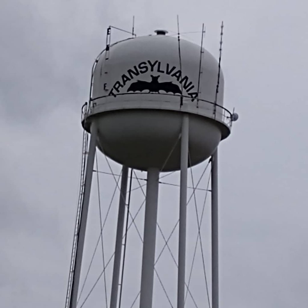
When we finally arrived in Transylvania, we saw the general store (which appeared to be closed for the day), the famous water tower with a giant bat on two sides, the Transylvania Post Office, and the permanently closed and abandoned Transylvania Elementary School. The town is surrounded by corn and cotton fields on all sides and the highways that lead into it (65 and 581) are dotted with prehistoric mounds built by the indigenous people that lived and/or traveled through the area. Some of these mounds predate Stonehenge (3000 BC) by as many as an estimated five hundred years. Many of these mounds are located on private property and can only be observed from the road. Once exception to this is the Poverty Point World Heritage Site. I’ll get to that wonderful place in a few minutes.

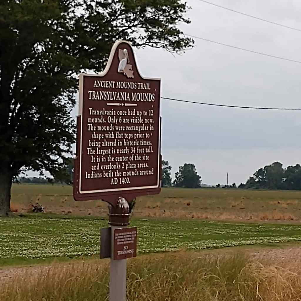
After visiting Transylvania, we headed north through Lake Providence and cut across to Oak Grove, LA, home of the Fiske Theatre, the oldest operating theater in northeast Louisiana and the last remaining single screen theater in operation (according to Wikipedia). It is on the National Register of Historic Places. Learn more about the theatre here. From there we headed back towards Transylvania via Highways 134 and 581. On Highway 581, we viewed the Transylvania Mounds and the Juice Mound.

After leaving Transylvania for a second time, we headed south to Alsatia and took Highways 580 and 577 to Poverty Point World Heritage Site. The site features six mounds identified as Mounds A-F. Mound A, also known as the Bird Mound, towers over the rest of the mounds at a height of seventy-two feet. It is 710 feet long and 660 feet wide. It is the largest mound in North America. No one knows exactly what purposes Mound A or any of the other mounds were used for, as they differ from all of the other mounds found in North America as far as found artifacts are concerned.
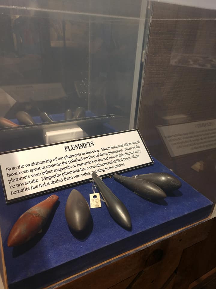
Many of the artifacts found at the site and on display in the museum are amazing. In particular, I found myself in awe of the plummets. Polished and drilled to be attached to things like nets, this things look like they were manufactured and not made by hand. I also really loved the figurines and and other small carved items on display at the museum.

Visitors are allowed to walk to the top of Mound A. Three types of tours are offered at the site. You can take a self-guided 2.6 mile hike, a driving tour, or a tram tour led by a tour guide. We went with the driving tour considering our late arrival time. You can learn more about Poverty Point World Heritage Site at their website. Be sure to check their website before visiting at this time, since COVID-19 has affected operations at the site.

After our visit to Poverty Point, we decided to head home. Instead of taking the same route we used to arrive in NE Louisiana, we ventured down Highway 17, hopped onto Interstate 20, and then quickly exited in Start, LA. From there, we headed south on Highway 133 (catching glimpses of the Boeuf River along the way), passed through Hebert, and eventually ended up in the lovely town of Columbia on the Ouachita River. In Columbia we hopped back onto Highway 165 and made our way back to the Lake Charles area.
Our trip to NE Louisiana was definitely one that we’ll remember. The small towns in the area appear to be hit pretty hard by poverty, but the history (and prehistory) of the area coupled with the agricultural heritage of the region make northeast Louisiana a great place to visit. I also recommend visiting Monroe and, if you have time, stopping across the Mississippi River in Vicksburg to check out that town which is also loaded with great attractions and history.
Thanks for reading my post. I’ll be hitting the trail again real soon!
All photos by me except where noted.
